
")
Kabul [Afghanistan], March 15 (ANI): An earthquake of magnitude 4.3 struck Afghanistan on Sunday, a statement by the National Center for Seismology (NCS) said.
The earthquake struck at a depth of 155km.
In a post on X, the NCS said, “EQ of M: 4.3, On: 15/03/2026 12:07:17 IST, Lat: 36.38 N, Long: 71.07 E, Depth: 155 Km, Location: Afghanistan.”
EQ of M: 4.3, On: 15/03/2026 12:07:17 IST, Lat: 36.38 N, Long: 71.07 E, Depth: 155 Km, Location: Afghanistan.
For more information Download the BhooKamp App https://t.co/5gCOtjdtw0 @DrJitendraSingh @OfficeOfDrJS @Ravi_MoES @Dr_Mishra1966 @ndmaindia pic.twitter.com/wctVZNRMzP— National Center for Seismology (@NCS_Earthquake) March 15, 2026
ADVERTISEMENT

Earlier on Saturday, another earthquake of magnitude 4.2 struck the region at a depth of 105km.
In a post on X, the NCS said, “EQ of M: 4.2, On: 14/03/2026 04:04:16 IST, Lat: 36.52 N, Long: 71.79 E, Depth: 105 Km, Location: Afghanistan.”
EQ of M: 4.2, On: 14/03/2026 04:04:16 IST, Lat: 36.52 N, Long: 71.79 E, Depth: 105 Km, Location: Afghanistan.
For more information Download the BhooKamp App https://t.co/5gCOtjdtw0 @DrJitendraSingh @OfficeOfDrJS @Ravi_MoES @Dr_Mishra1966 @ndmaindia pic.twitter.com/QNHSaMb4N8— National Center for Seismology (@NCS_Earthquake) March 13, 2026
Earthquakes can occur anywhere between the Earth’s surface and about 700 kilometres below the surface. For scientific purposes, this earthquake depth range of 0 – 700 km is divided into three zones: shallow, intermediate, and deep, as per USGS data.
Shallow earthquakes are between 0 and 70 km deep; intermediate earthquakes, 70 – 300 km deep; and deep earthquakes, 300 – 700 km deep. In general, the term “deep-focus earthquakes” is applied to earthquakes deeper than 70 km, the USGS states.
Shallow earthquakes are generally more dangerous than deep earthquakes. This is because the seismic waves from shallow earthquakes have a shorter distance to travel to the surface, resulting in stronger ground shaking and potentially more damage to structures and greater casualties.
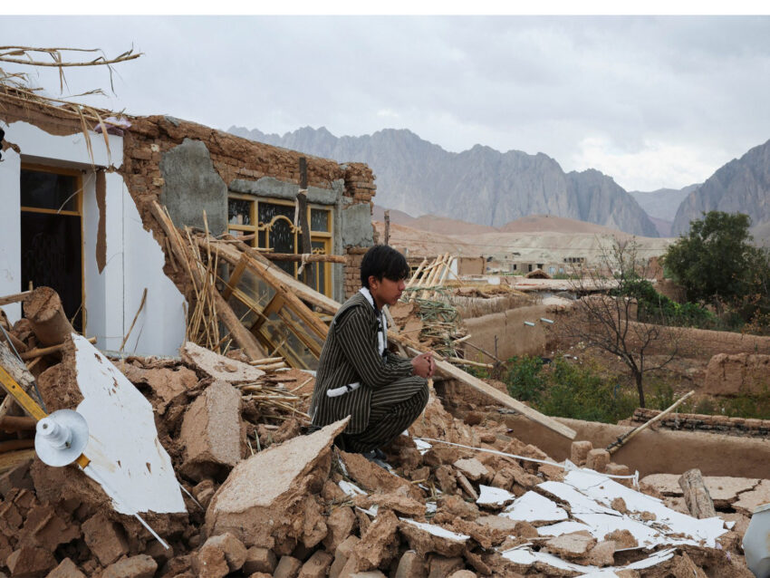
Afghanistan frequently experiences earthquakes, particularly in the Hindu Kush region, which lies in a highly active seismic zone, according to the Red Cross.
Afghanistan’s vulnerability to earthquakes is linked to its location along the collision zone between the Indian and Eurasian tectonic plates. A major fault line also passes through parts of the country, including the Herat region.
The United Nations Office for the Coordination of Humanitarian Affairs (UNOCHA) notes that Afghanistan remains extremely vulnerable to natural disasters, including earthquakes, landslides and seasonal flooding. Repeated tremors worsen the situation for communities already struggling with decades of conflict and limited development, leaving them with minimal resilience to withstand multiple shocks. (ANI)